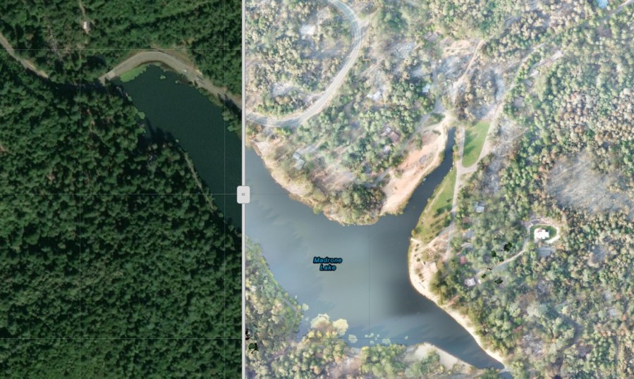
ALAMEDA COUNTY, Calif. (KRON) — Destruction from the deadly Bear Fire, also known as the North Complex West Zone fire, was difficult for Butte County emergency officials to assess quickly.
The Butte County Sheriff’s Office requested assistance from drone experts in Alameda County to assess the destruction from a bird’s-eye-view. They deployed a drone to conduct a rapid areal assessment over 50-square-miles of burned forests and homes. The drone team also created before and after photographs of Berry Creek, the area where the worst devastation and most fatalities occurred.
Greg Crutsinger, a mapping expert and director of applied research at GeoAcuity, helped the Sheriff’s Office complete the project in 72 hours.
He said the images not only help emergency officials, but also evacuated residents and fire victims who have not been able to return home.
“Drones are great story-telling tools, but they are also great at quantifying damage and the impact on this community. Particularly Butte County, this is a community that knows wildfires and knows what it means from this fire and previous fires,” Crutsinger said.

